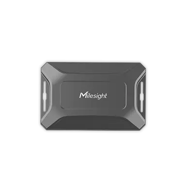
Milesight AT101: LoRaWAN GPS & Wi-Fi Asset Tracker
Milesight AT101 LoRaWAN asset tracker: GNSS plus Wi-Fi positioning, own ChirpStack/ThingsBoard decoder, decoded example, geofencing and fleet integration.
- LoRaWAN
- Class A, OTAA
- Positioning
- GNSS (GPS/BeiDou) + Wi-Fi scan
- Ingress protection
- IP67
- Sensors
- Temperature, tilt, tamper
- Battery
- Up to 15 years (2 fixes/day)
- Range
- Up to 15 km rural, 2 km urban
- Configuration
- NFC / Bluetooth (Milesight ToolBox)
What the AT101 measures
Location
Latitude/longitude from GNSS or Wi-Fi MAC scan, scaled by 1,000,000.
Motion status
Start, moving and stop states from the built-in accelerometer.
Geofence status
Inside, outside or unset against the configured virtual perimeter.
Temperature
On-board temperature with optional abnormal-temperature alarm.
Tilt and tamper
Device position (normal/tilt) and install/uninstall tamper events.
Integration
Sensor / controller
Measures or controls in the field and sends LoRaWAN uplinks.
LoRaWAN gateway
Receives the radio packets and forwards them to the server.
ChirpStack
Network server: manages sessions and decodes the payload.
ThingsBoard / Grafana
Dashboards, alarms, rules and reports.
function decodeUplink(input) {
  var bytes = input.bytes;
  var data = {};

  for (var i = 0; i < bytes.length; ) {
    var channel = bytes[i++];
    var type = bytes[i++];

    if (channel === 0x01 && type === 0x75) {            // battery (%)
      data.battery = bytes[i]; i += 1;
    } else if (channel === 0x03 && type === 0x67) {     // temperature (°C)
      data.temperature = readInt16LE(bytes, i) / 10; i += 2;
    } else if (channel === 0x83 && type === 0x67) {     // temperature + alarm flag
      data.temperature = readInt16LE(bytes, i) / 10;
      data.temperature_alarm = bytes[i + 2] === 1 ? "abnormal" : "normal";
      i += 3;
    } else if ((channel === 0x04 || channel === 0x84) && type === 0x88) { // location
      data.latitude = readInt32LE(bytes, i) / 1000000;
      data.longitude = readInt32LE(bytes, i + 4) / 1000000;
      var status = bytes[i + 8];
      data.motion_status = MOTION[status & 0x0f];
      data.geofence_status = GEOFENCE[status >> 4];
      i += 9;
    } else if (channel === 0x05 && type === 0x00) {     // device position
      data.position = bytes[i] === 1 ? "tilt" : "normal"; i += 1;
    } else if (channel === 0x07 && type === 0x00) {     // tamper status
      data.tamper_status = bytes[i] === 1 ? "uninstall" : "install"; i += 1;
    } else if (channel === 0x06 && type === 0xd9) {     // Wi-Fi scan result
      var wifi = {
        mac: readMAC(bytes, i + 1),
        rssi: readInt8(bytes[i + 7])
      };
      data.wifi = data.wifi || [];
      if (wifi.mac !== "ff:ff:ff:ff:ff:ff") data.wifi.push(wifi);
      i += 9;
    } else {
      break;                                            // unknown channel
    }
  }
  return { data: data };
}

var MOTION = { 0: "unknown", 1: "start", 2: "moving", 3: "stop" };
var GEOFENCE = { 0: "inside", 1: "outside", 2: "unset", 3: "unknown" };

function readInt8(b) { return b > 0x7f ? b - 0x100 : b; }
function readInt16LE(b, i) {
  var v = (b[i + 1] << 8) | b[i];
  return v > 0x7fff ? v - 0x10000 : v;
}
function readUInt32LE(b, i) {
  return ((b[i + 3] << 24) | (b[i + 2] << 16) | (b[i + 1] << 8) | b[i]) >>> 0;
}
function readInt32LE(b, i) {
  var v = readUInt32LE(b, i);
  return v > 0x7fffffff ? v - 0x100000000 : v;
}
function readMAC(b, i) {
  var out = [];
  for (var k = 0; k < 6; k++) out.push(("0" + (b[i + k] & 0xff).toString(16)).slice(-2));
  return out.join(":");
}
Implemented from the published Milesight byte specification (Communication Protocol / User Guide).
Channel format: 01 75 battery (%), 03 67 temperature (INT16 little-endian, /10), 83 67 temperature with an abnormal-alarm flag, 04/84 88 location (latitude and longitude as INT32 little-endian, /1,000,000) plus a status byte where the low nibble is motion and the high nibble is geofence, 05 00 device position (tilt), 07 00 tamper. Implemented from the published Milesight byte specification. When the tracker is set to Wi-Fi positioning it sends 06 D9 scan results (BSSID list) instead of a GNSS fix, which a location backend resolves to coordinates. For ThingsBoard the same channel logic goes into an uplink converter.
Uplink (hex)
0175640367EB000488C283DE0256A0B00002050001070000Decoded JSON
{ "battery": 100, "temperature": 23.5, "latitude": 48.137154, "longitude": 11.575382, "motion_status": "moving", "geofence_status": "inside", "position": "tilt", "tamper_status": "install" }Use cases
Configuration & pitfalls
GNSS vs Wi-Fi positioning
GNSS gives outdoor accuracy, Wi-Fi MAC scanning works indoors but needs a geolocation backend to resolve BSSIDs to coordinates. Pick the strategy per use case, the payload layout changes with it.
Reporting strategy
Periodic, motion-triggered and timing modes trade battery life against freshness. Motion mode saves power but only reports while assets move, plan dashboard timeouts accordingly.
Geofence setup
Center coordinates and radius are configured on the device. Outside or inside transitions arrive as a status byte, so dashboard rules should treat them as priority events.
GNSS fix timeout
A cold fix can take longer under poor sky view. Set a realistic positioning timeout so the tracker does not drain battery hunting for satellites indoors.
How merkaio supports your AT101
From sourcing to day-to-day operation, all from one partner on our own European infrastructure.
Pre-staging & provisioning
We configure the AT101, set keys, intervals and alarms, and ship it ready to deploy.
Own decoder
Payload codec for ChirpStack v4 and ThingsBoard, implemented from the Milesight specification.
Dashboard integration
Data lands in your ThingsBoard or Grafana, with alarms and reports.
Operations & monitoring
We run the LoRaWAN stack and dashboards on European infrastructure, you just use the data.
Frequently asked questions
Let's discuss your infrastructure. Digital and on-site.
Whether it's IoT platform development, hardware selection, managed hosting for ChirpStack, ThingsBoard, Grafana or NetBird VPN, or migration from a self-hosted setup - we'll find the right solution for your use case. Book a free 30-minute consultation, no commitment required.

Your contact
Timo Wevelsiep
Founder, merkaio
15 minutes, no commitment, directly with Timo.
Decoder for ChirpStack v4. merkaio is an independent integrator and is not affiliated with Milesight.